
Pardon our Dust - Roadways Under Construction
/Pardon our dust! Numerous roadways are simultaneously under construction in New Albany to help motorists and pedestrians travel safer. To help keep you informed and up-to-date, we've put together a list that explains each project.
Spring Street

Spring St. and Silver St. Intersection

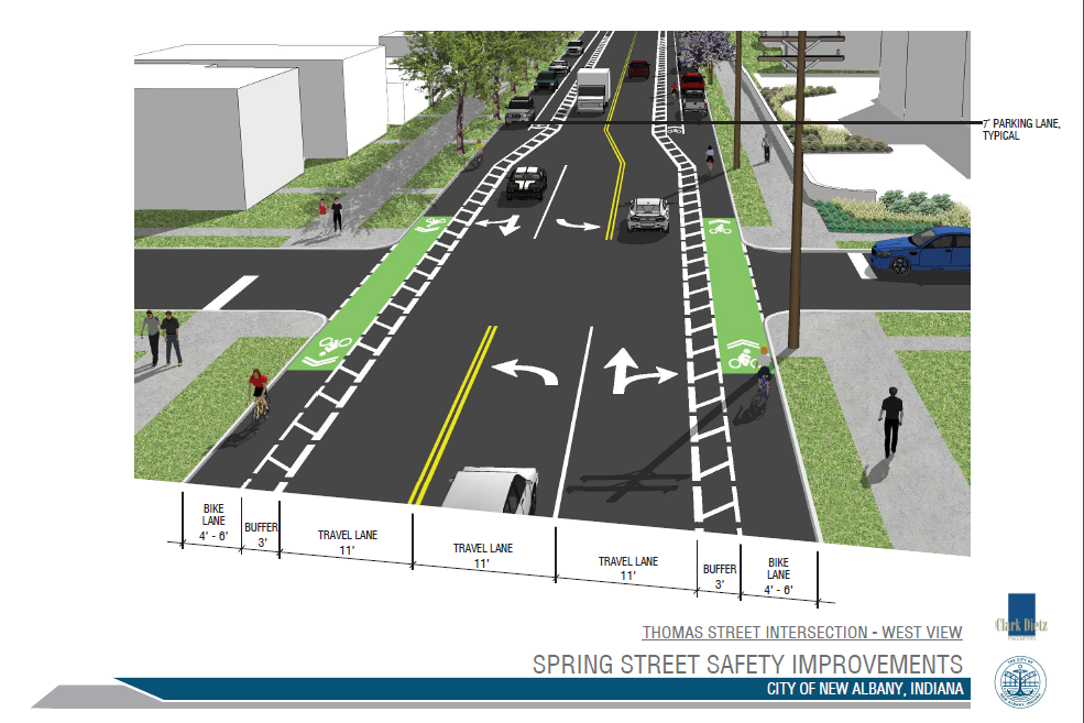
Spring St. and Thomas St. Intersection
This safety and roadway improvement project received special federal Highway Safety Improvement Program grant money to help correct the roadway. To read the full details of the project, please click HERE.
This project began yesterday morning (Monday, July 11th), and experienced heavy congestion through rush hour. To combat this, we have adjusted the signal timings to allow smoother access moving East-West along Spring Street. We will continue monitoring the traffic in this area and adjusting signals as necessary to make it as smooth as possible during construction.
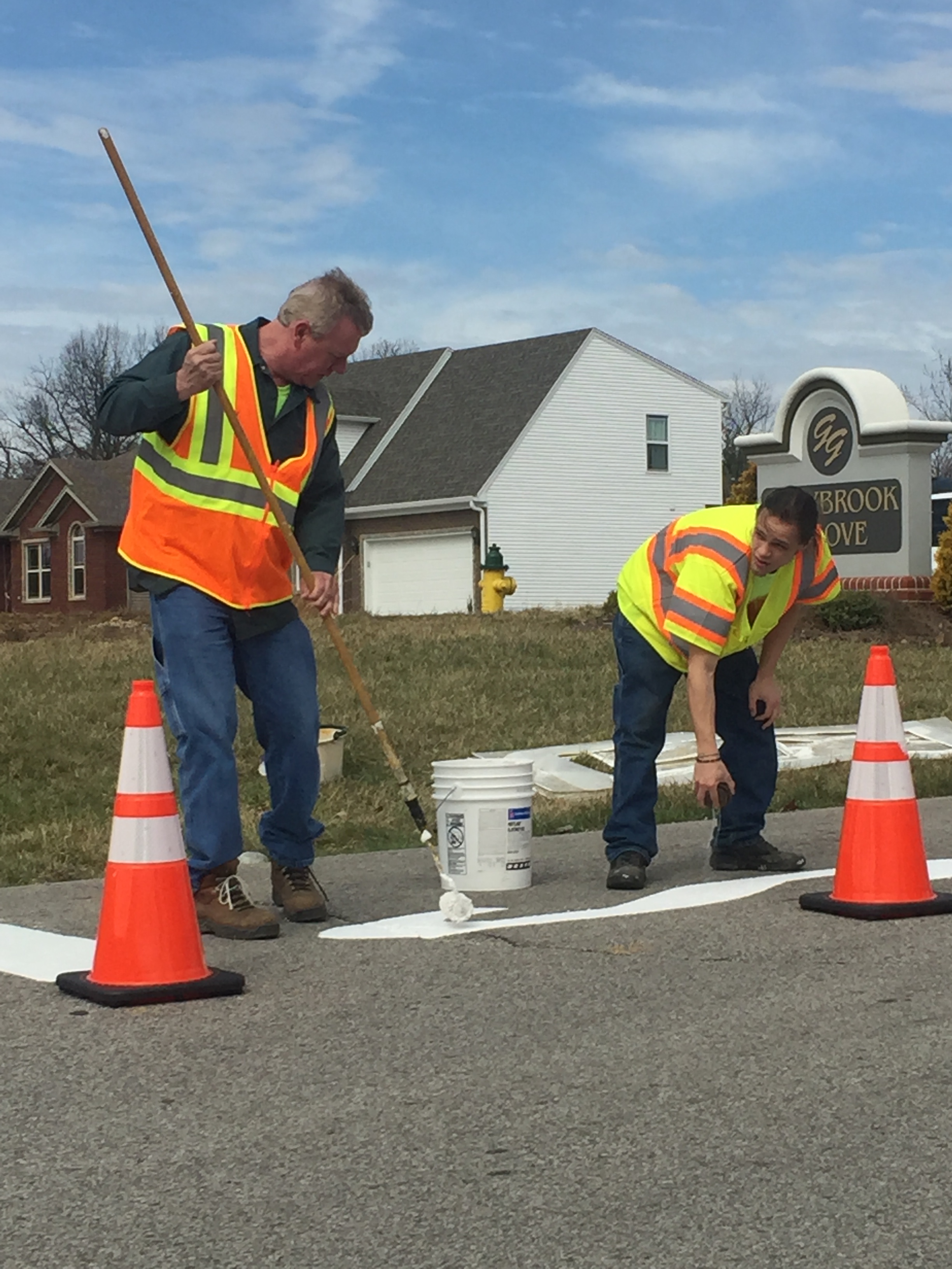
Bono Road
Bids were opened at today’s Redevelopment Commission for the full reconstruction of Bono Road. Construction has been ongoing in the area, as utility companies have mobilized to repair and re-run lines before the road construction begins. Due to the base failure, many potholes and cracks had opened in the roadway, which has now prompted the full-depth reconstruction and re-paving of the roadway. This project is estimated to be completed in mid-November. Travel will be limited to local access only. For all others, a detour will take motorists from Green Valley Road to Daisy Lane to Graybrook.
McDonald Lane

McDonald Lane near Charlestown Road

McDonald Lane facing Grant Line Road
Phase 1 of the project, from Charlestown Road to Hickory Vale is currently underway. This phase calls for a full complete reconstruction of the pathway. During this phase, curbs, gutters, and complete stormwater system are being added, new traffic signals, along with sidewalks and new road reconstruction and paving. This project is expected to be complete in the Fall of 2017.
From August 2nd through August 4th, the railroad crossing on McDonald Lane (near Bruce Fox) will be closed so that the railway can complete a full replacement of the crossing.
5th and Elm
After digging up the intersection, it was discovered that water was escaping the stormsewer system during heavy rains. This caused nearby soil to wash away, and the roadway to begin sinking, forming the "dip" in the road. Over time, this also caused the sewer and stormwater lines to shift. This project will repair those lines, and repair the foundation of the roadway all the way to the bedrock to ensure that the system will not move in the future.
Update on City-wide Paving Project
Over the past month, crews began replacing sidewalk ramps to meet ADA standards ahead of scheduled city-wide paving. Paving is scheduled to begin July 25th.