
First Phase of Monon South Freedom Trail
The Monon South Trail will run from New Albany and go 63 miles winding north past Mitchell, Indiana. Outside of Floyd County, the trail is managed by Radius Indiana (from the Floyd County line north). The City of New Albany is responsible for the portion from the Ohio River Greenway to the county line. The section of trail that the City of New Albany is constructing has been named the Monon South Freedom Trail, honoring its historic roots as a verified escape route for enslaved African Americans.

A map showing the first “downtown phase” of the monon south freedom trail in new albany
The first phase of the Freedom Trail began in early August of 2025, and will branch off of the Ohio River Greenway into downtown New Albany. The trail will head North along 4th Street and stretch past Fairview Cemetery. Radius Indiana has begun construction on their portion of the trail, and you can see their progress at www.mononsouth.com
History of this “Rails to Trails” Initiative
In 2017, CSX abandoned its rail line from the northern edge of New Albany to the East Fork of the White River, south of Bedford. This created a once-in-a-lifetime opportunity to develop a new, 63-mile-long recreational trail stretching through 5 Indiana counties (Clark, Floyd, Lawrence, Orange, and Washington), and connecting nine Indiana towns and cities (Bedford, Mitchell, Saltillo, Campbellsburg, Salem, New Pekin, Borden, Orleans, and New Albany).
When completed, the full Monon South trail will be the longest, continuous recreation trail in Indiana, creating immense recreation and economic opportunities for the region.
The City of New Albany is excited and humbled to have an opportunity to not only bring a new amenity to the region, but to reimagine the former New Albany – Salem railroad while paying homage to its significance as part of the Underground Railroad. The railway served as a verified escape route serving as a pathway to freedom for many enslaved African Americans traveling both in train cars and following the tracks by foot.
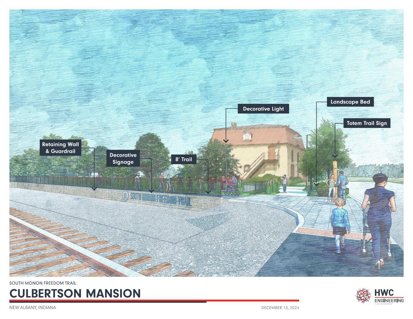
Rendering of trail near 10th street in downtown new albany
Impacts

Funding
The City applied for and received the Indiana READI (Regional Economic Acceleration and Development Initiative) grant to help connect the Ohio River Greenway system to the 68-mile long South Monon Freedom Trail. When connected, this would tie the Monon South Freedom Trail into the current Ohio River Greenway trails system, which further connects into Clarksville, Jeffersonville and the Big Four Bridge, and the Louisville Trail Loop System, culminating in a massive recreational parks and trails system.
The trail has also been funded through Indiana Department of Natural Resources, Indiana’s Next Level Trails grant program, and with support through our trail partners at Radius Indiana.
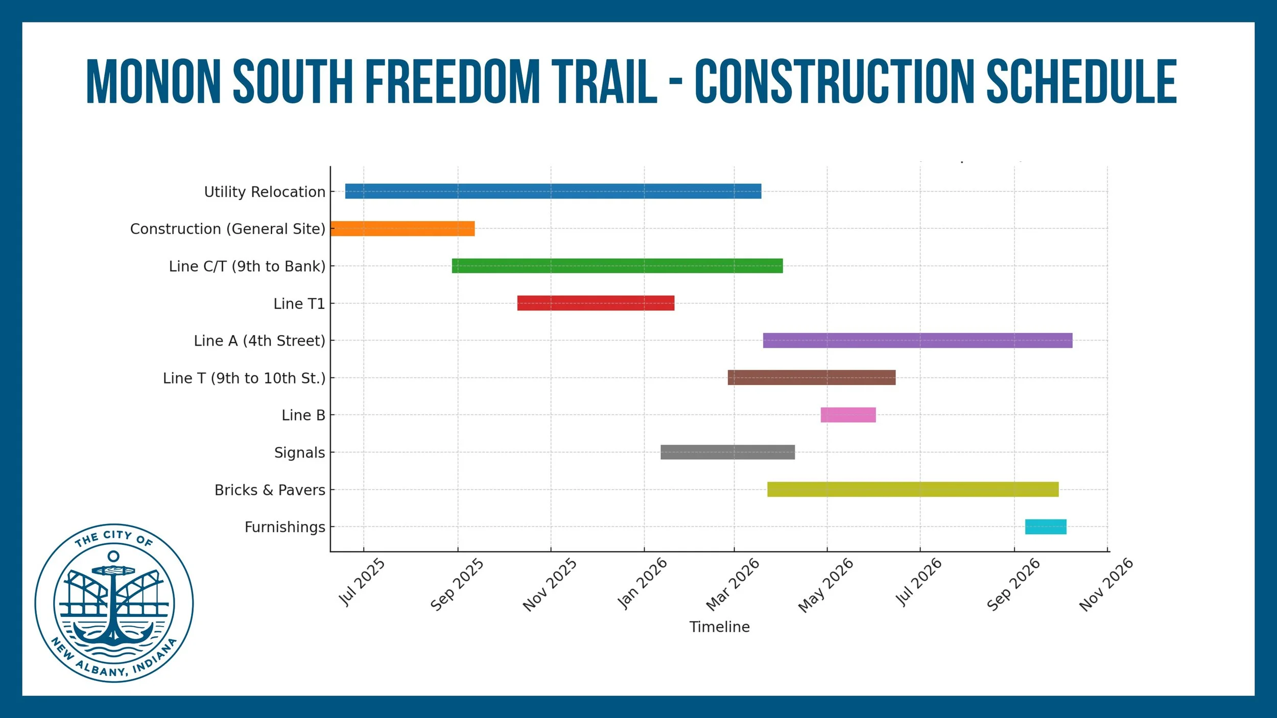
Recent Updates from Construction Crew:
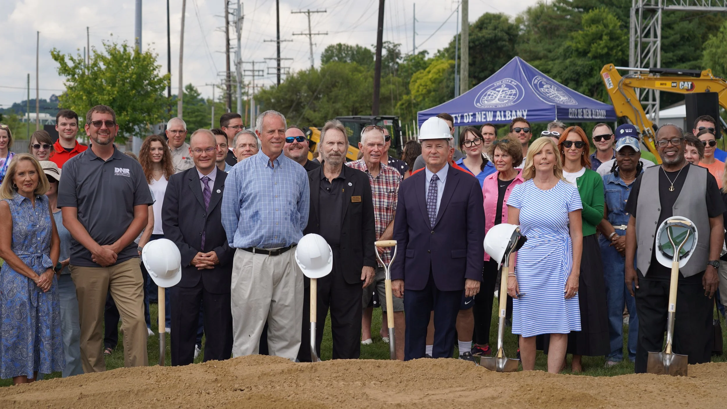
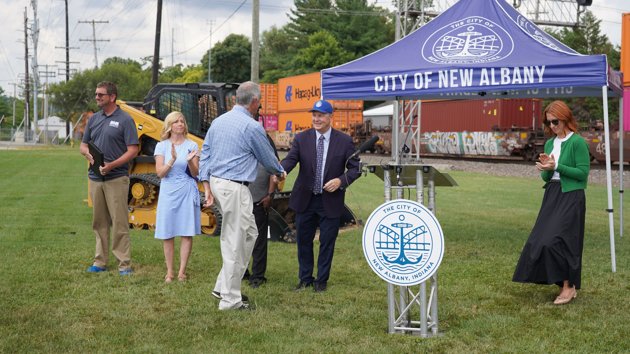
Construction Crews began to mobilize on August 1st, 2025. A groundbreaking was held on August 14, 2025 at 11:00 a.m. Letters were sent to adjacent property owners to inform them of upcoming work.
-
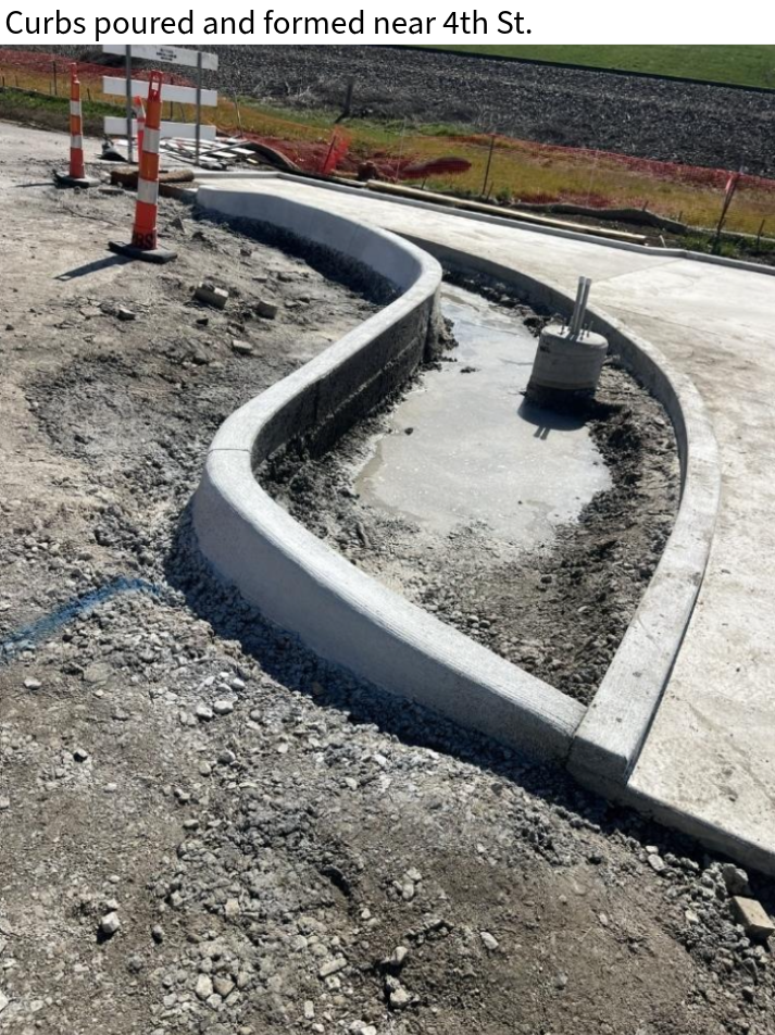
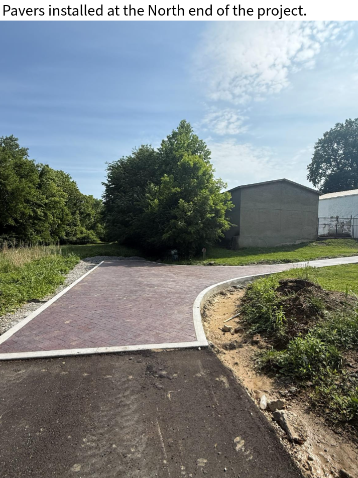
7/15/26
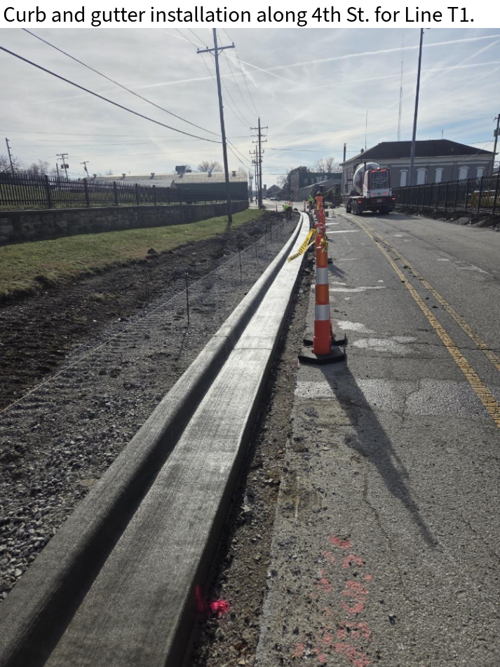
Curb, sidewalk, and light pole foundations continued to be poured along 4th Street between Main Street and Spring Street.
The dumpster pad for Hugh E. Bir's has been poured.
An anti-graffiti coating has been applied to the wall near the Culbertson Mansion.
PLEASE DO NOT WALK ON THROUGH DESIGNATED CONSTRUCTION AREAS
-
7/08/26
A paver base, curb, and curb ramp were prepared and poured at the intersection of Main Street and 4th Street.
Light pole installation continued on the north end of the project.
Storm structures, along with connecting storm sewer pipes, were installed near 4th Street south of Elm Street.
7/01/26
Crews prepared and poured curb ramps and curbs at the southwest corner of Main Street and 4th Street.
Light pole installation began on the north end of the project near 8th Street.
Trench drains were excavated, landscaping soil was placed, and subgrade treatment was installed along and near 4th Street.
6/25/26
The green and blue pavement markings along 10th Street have been completed. Precast dividers were also installed in the area.
Excavation and general preparation of the stormwater planter areas between Market Street and Spring Street are ongoing.
Crews continued placing subgrade treatment and pouring curbs and paver base along 4th Street.
6/16/26
Crews finished placing seed and straw on both sides of the trail between 3rd Street and 6th Street.
The existing sidewalk between Market Street and Spring Street was excavated, and conduit installation began in the same area.
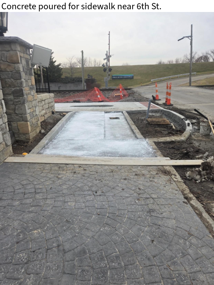
The paver base south of Main Street was completed, and sidewalk concrete is currently being poured between Main Street and Market Street.
6/09/26
Stone was installed and compacted in preparation for the concrete paver base and sidewalk between Main Street and Market Street.
Crews poured concrete for the paver base, as well as curbs within multiple landscaping beds and storm planters south of Main Street.
Decorative painting has begun along the trail on 10th Street, extending from the floodwall toward the Culbertson Mansion.
The project is now estimated to be 57% complete.
6/02/26
Preparation has begun along 4th Street south of Market Street for curb and sidewalk installation.
Crews placed topsoil along the sides of the trail on the north end of 4th Street near the cemetery.
Concrete for the paver base was formed and poured in areas along 4th Street south of Main Street.
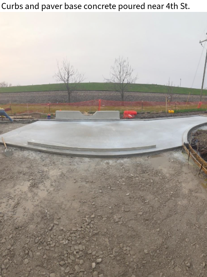
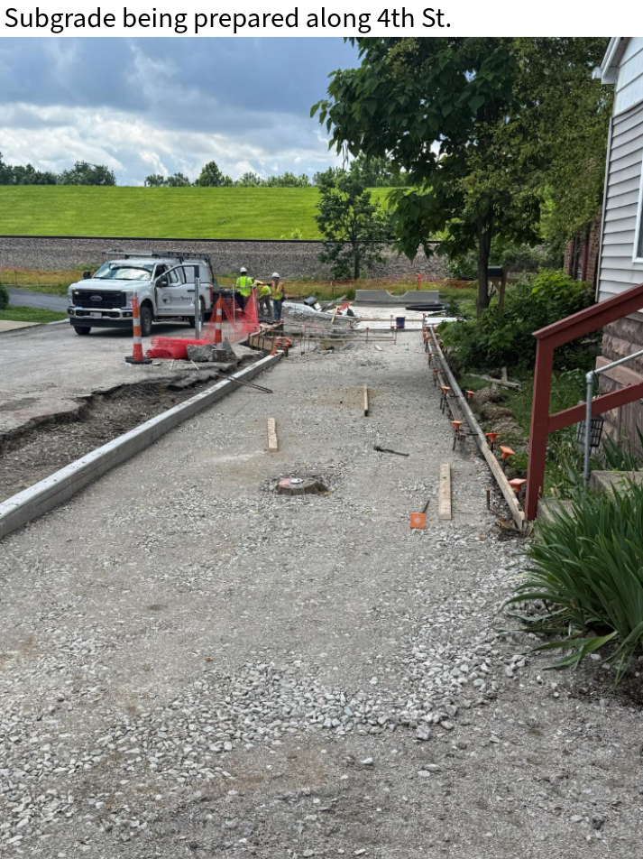
5/27/26
Crews completed preparation of subgrade treatment for curb installation along 4th Street between Main Street and Market Street.
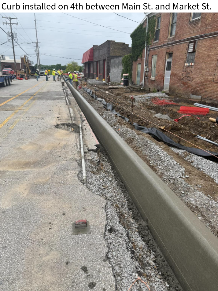
Curb installation has been completed on 4th Street from the south end of the project to Market Street.
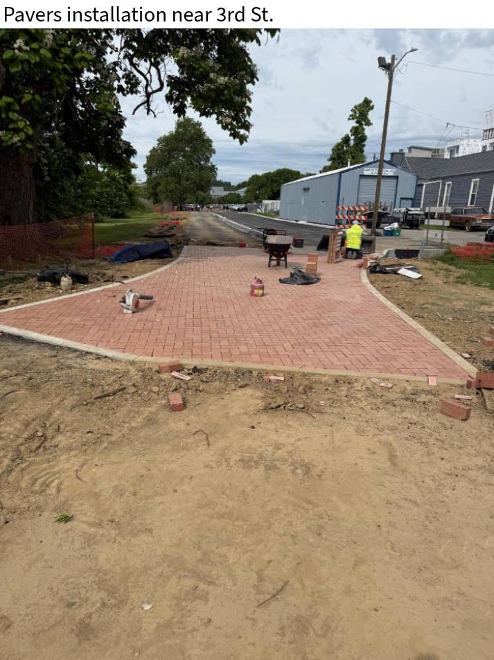
Paver installation continues at both 8th Street and 5th Street.
5/19/26
Subgrade treatment was placed between Main Street and Market Street in preparation for curb and gutter installation.
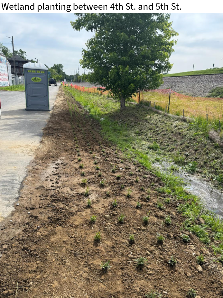
Bulbs were planted in the ditch line for the wetland planting area between 4th Street and 5th Street.
Paver installation began at the south end of the project.
Additionally, crews installed anchor bases for the HAWK signal that will be placed along Main Street.
5/12/26
Crews installed new storm structures at 4th Street and Spring Street, along with tying in existing storm sewer pipes.
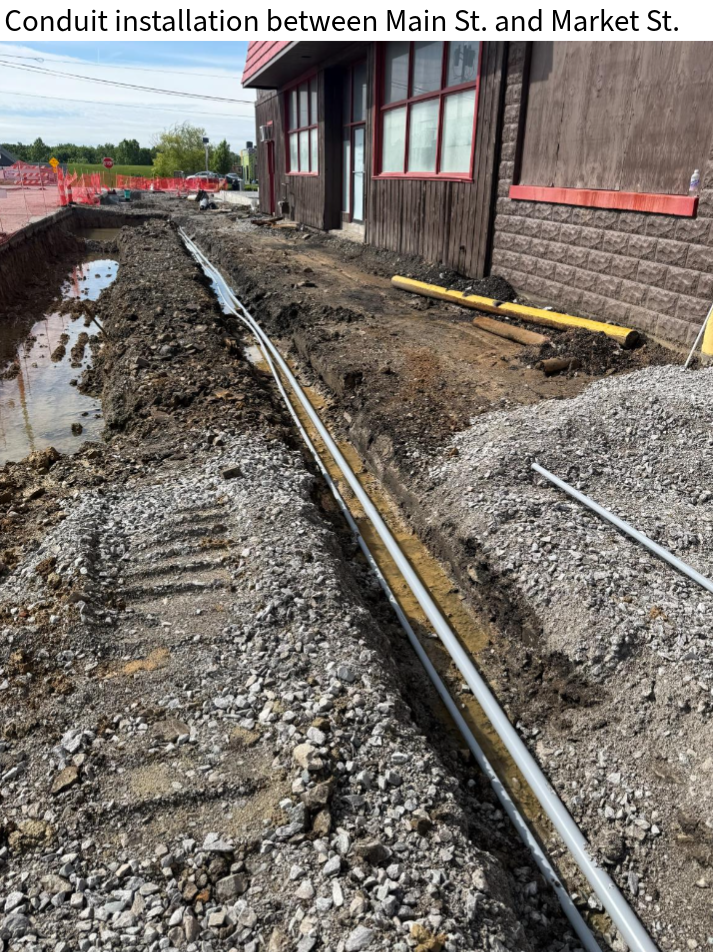
Excavation and conduit installation between Main Street and Market Street continued.
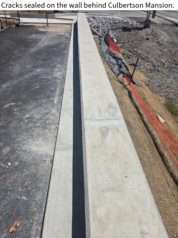
Crack sealing has been completed on the wall behind Culbertson Mansion.
5/06/26
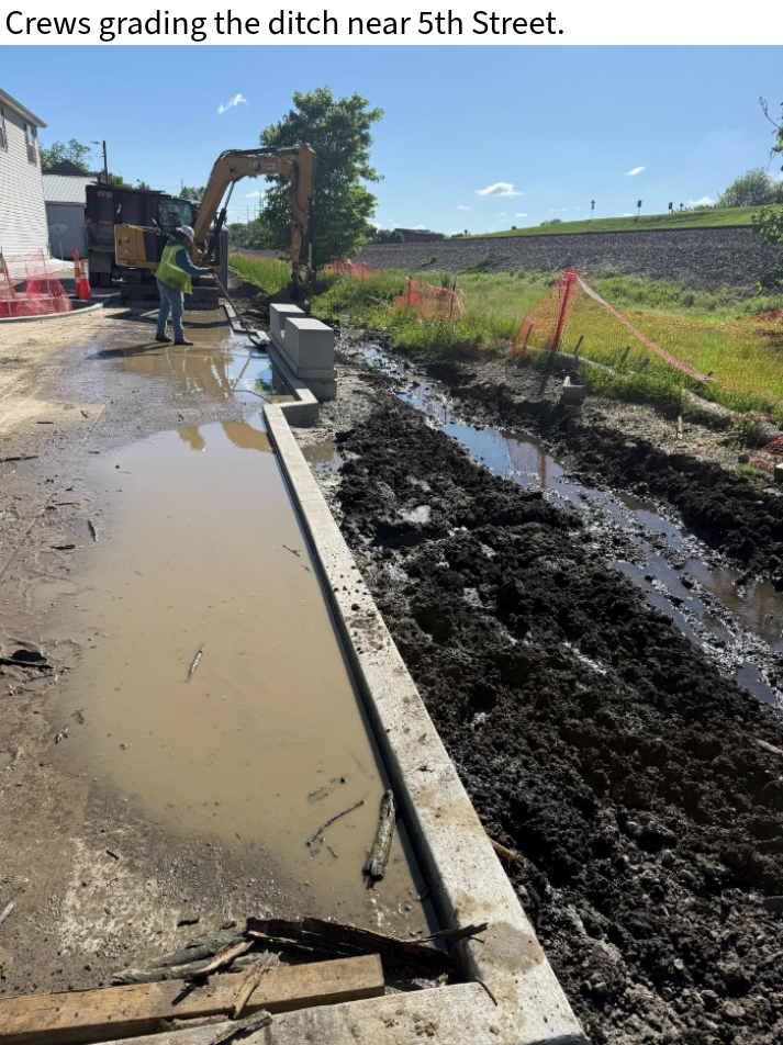
The job site was cleaned, and the ditch in Line T was regraded in response to recent rainfall.
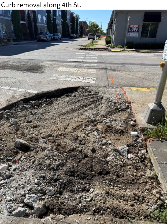
Crews continued to remove existing sidewalk and curb ramps along 4th Street between Main Street and Culbertson Avenue.
Light pole preparations were completed for boring operations at intersections along 4th Street.
4/28/26
Crews removed existing sidewalk and curb along 4th Streeet between Main Street and Culbertson Avenue.
Concrete was formed and poured on 4th Street south of Main Street.
The Project is now estimated to be 37% complete.
4/21/26
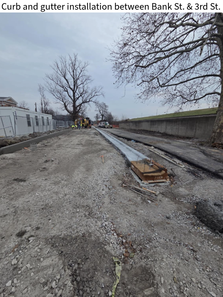
Asphalt paving was completed between 9th Street and 10th Street, along 5th Street, between Bank Street and 3rd Street, and between Culbertson Avenue and the paver area near the 8th Street crossing. Surface asphalt paving will take place further into the project.
Crews finished removing existing concrete at the intersection of 4th Street and Main Street in preparation for the installation of structures and a storm sewer.
In addition, crews excavated a conduit trench and installed conduit, pulled wire, performed traffic signal work, and relocated a gas utility.
4/13/26
Excavation has begun on the electrical conduit trench to run along 4th Street south of Main Street. Delta Electrical was on site to install the conduit.
Crews also began removing existing conrete near the south west intersection of 4th Street and Main Street.
Landscaping crews were onsite installing seed and straw along the trail between 9th Street and Bank Street.
4/09/26
Crews began grading the subgrade along 4th Street north of Culbertson Avenue in preparation for base asphalt.
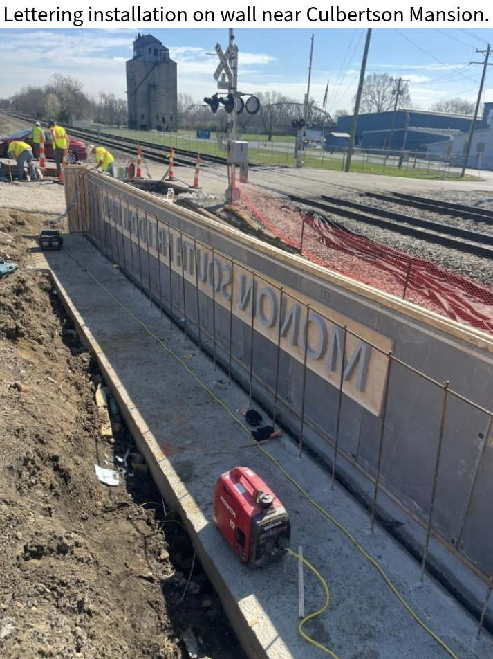
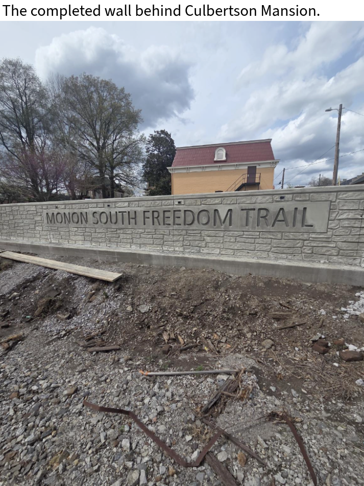
The wall behind Culbertson Mansion was finished.
Sidewalk connecting the trail to 8th Street was formed and poured; curb ramps remain to be completed.
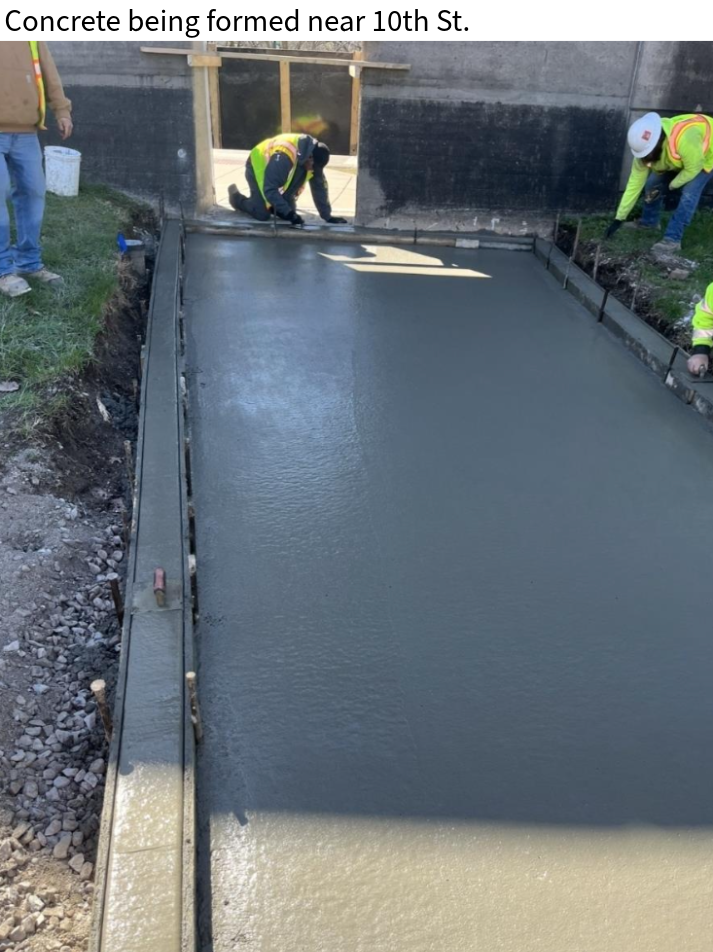
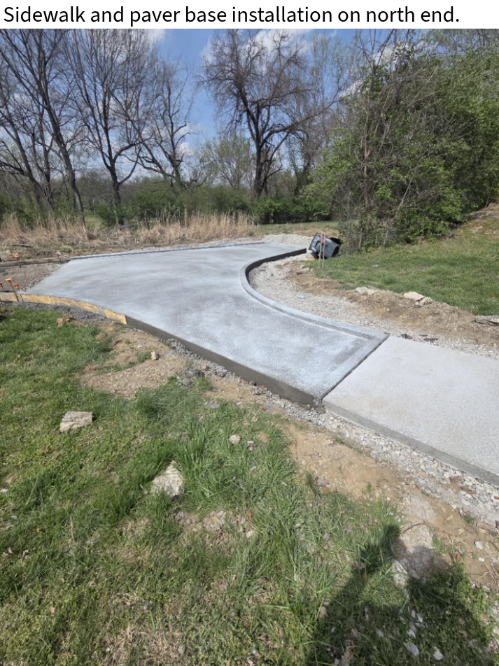
Concrete paver base was poured for the paver area at the north end of the trail.
4/01/26
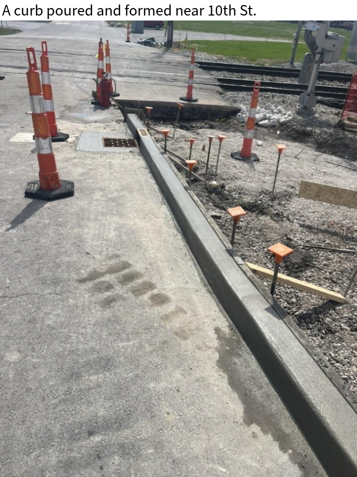
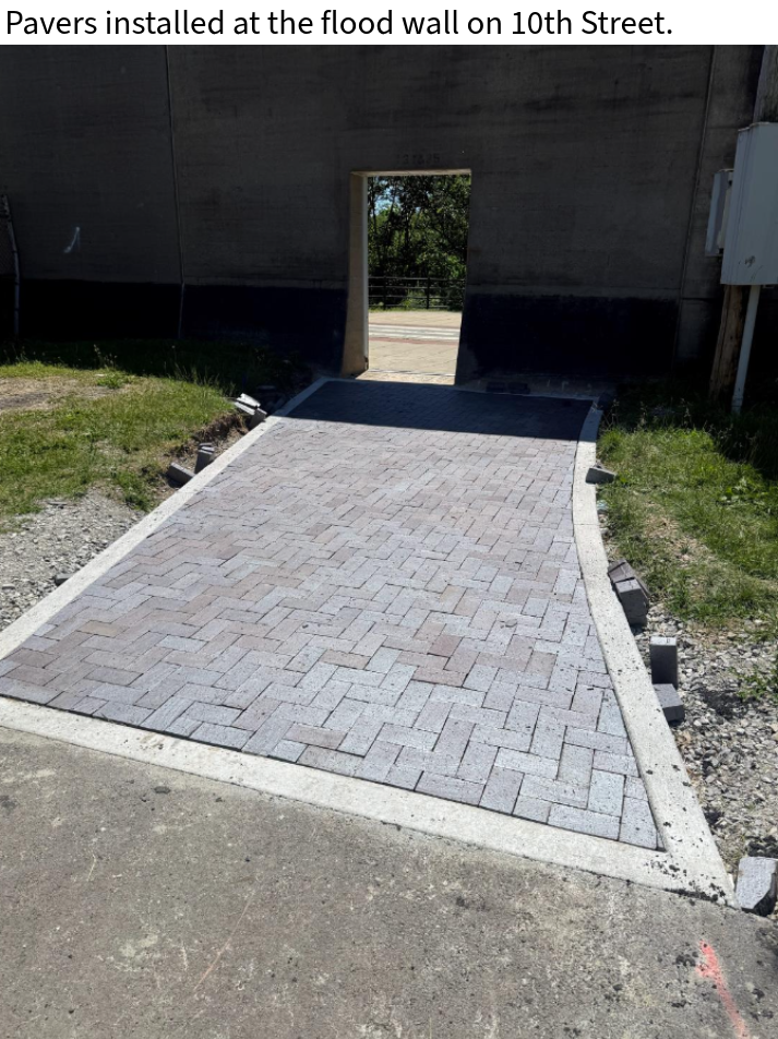
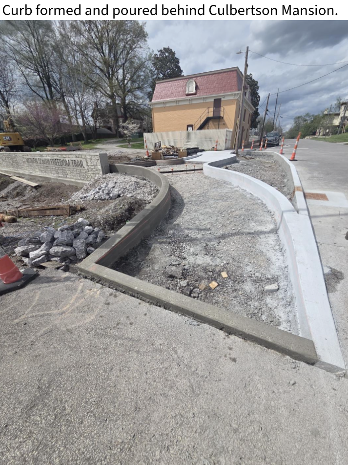
Concrete was formed and poured for the paver base at the floodwall and for the curb near the railroad tracks by 10th Street.
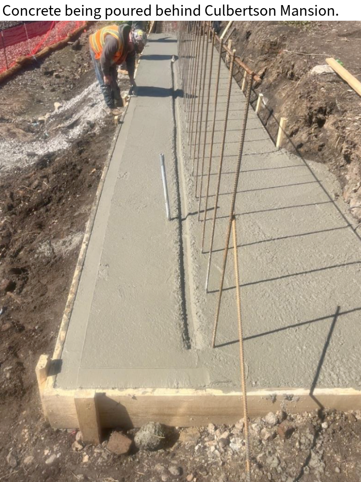
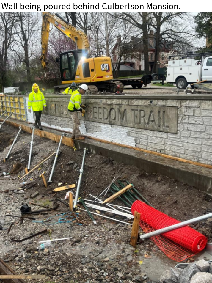
Crews completed installation of reinforcement bars and formed the retaining wall behind the Culbertson Mansion between 10th Street and 9th Street.
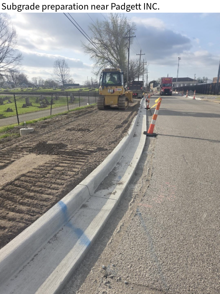
Excavated material stockpiled near Padgett, Inc. continues to be hauled off site.
Grading work has begun in preparation for asphalt paving along 4th Street.
3/23/26
Crews continue to work on the wall behind Culbertson Mansion between 10th Street and 9th Street.
Excavated material was removed from the north end of the job near 4th Street; concrete was also removed from the sidewalk area near 8th Street.
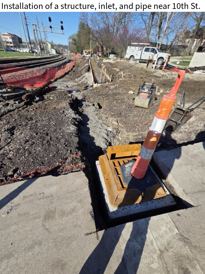
A concrete collar for the pipe and structure as well as a curb was poured near 10th Street. Additionally, a curb was poured on 4th Street.
3/13/26
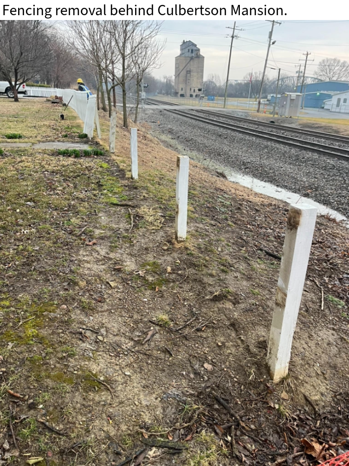
Excavation was completed behind Culbertson Mansion in preparation for the retaining wall. The footer for the wall was also formed and poured. Prior to beginning this work, crews conducted training and safety briefings, and a flagger will be on site until the wall is complete.
A storm structure and corrugated pipe were installed near 10th Street.
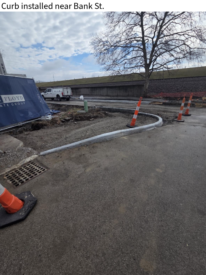
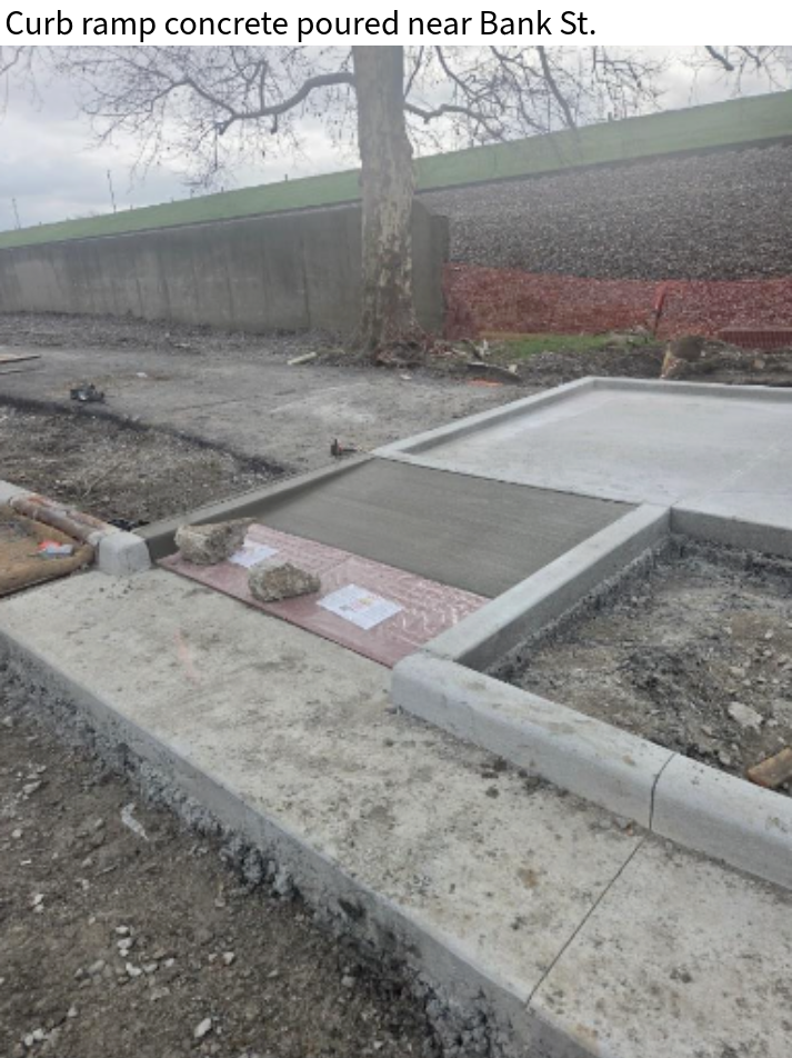
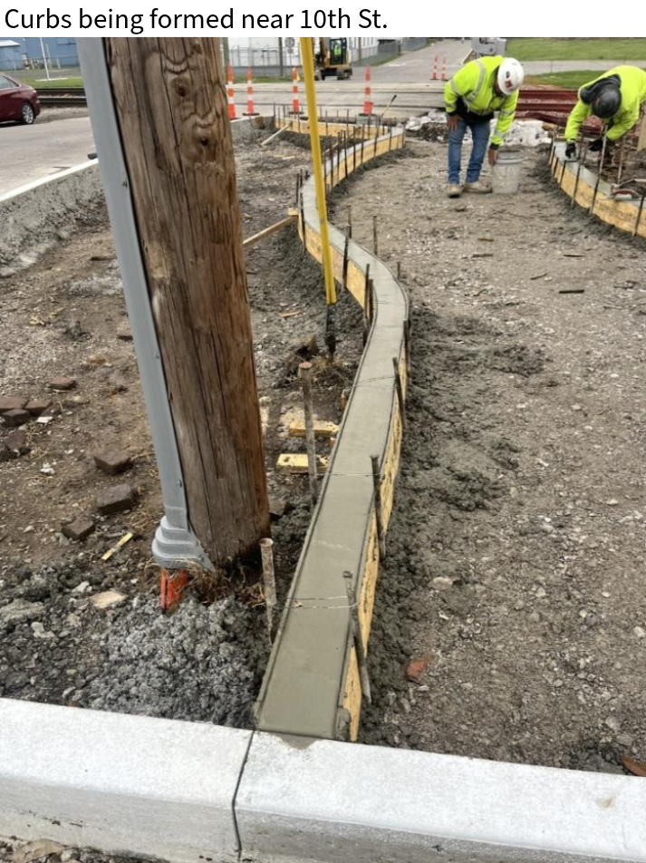
Crews also formed and poured concrete for curbs and the paver base near 4th Street and Bank street. Additionally, sidewalk and curb ramps were poured near Bank Street.
3/06/26
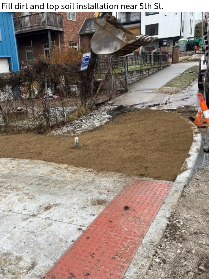
Crews installed fill dirt along the trail between 9th Street and 5th Street.
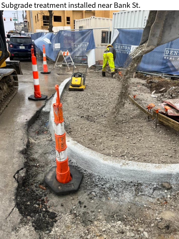
Subgrade treatment was installed for the sidewalk, curb, and gutter in several locations between 6th Street and Bank Street in preparation for concrete.
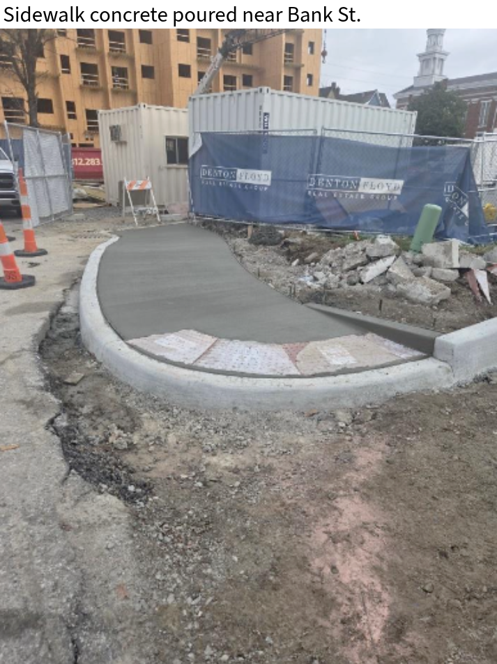
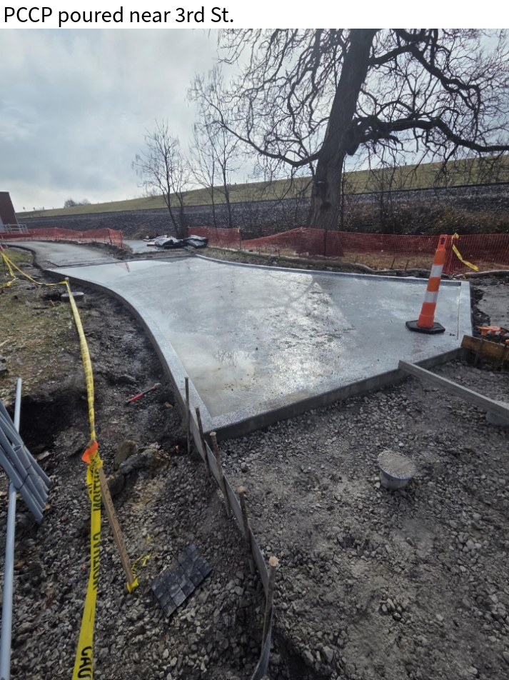
Concrete crews poured sidewalk, 4" PCCP, cubs, and gutters in several locations between 4th Street and Bank Street.
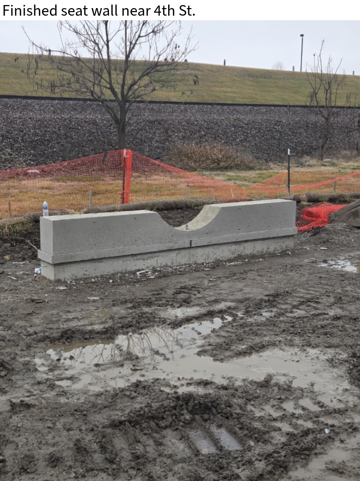
3/02/26
Crews installed fill and topsoil at the end of 5th Street and in the ditch line between 5th Street and 3rd Street for wetland plantings.
The seat wall near 4th Street was finished.
Subgrade treatment was installed for the sidewalk, curb, and gutter in several locations between 3rd Street and 6th Street.
Sidewalk concrete was poured at 5th Street and 6th Street. Additionally, curbs were poured on 4th Street and 3rd Street; 3rd Street also had a gutter poured.
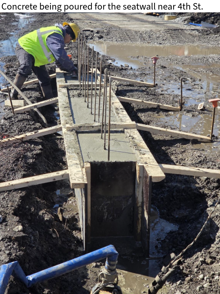
2/17/26
Crews formed and poured the seat wall foundation near 4th Street.
Two separate crews were on site to relocate water utilities along 4th Street. One crew worked between Culberston Avenue and Spring Street, while the other worked between Market Street and Main Street.
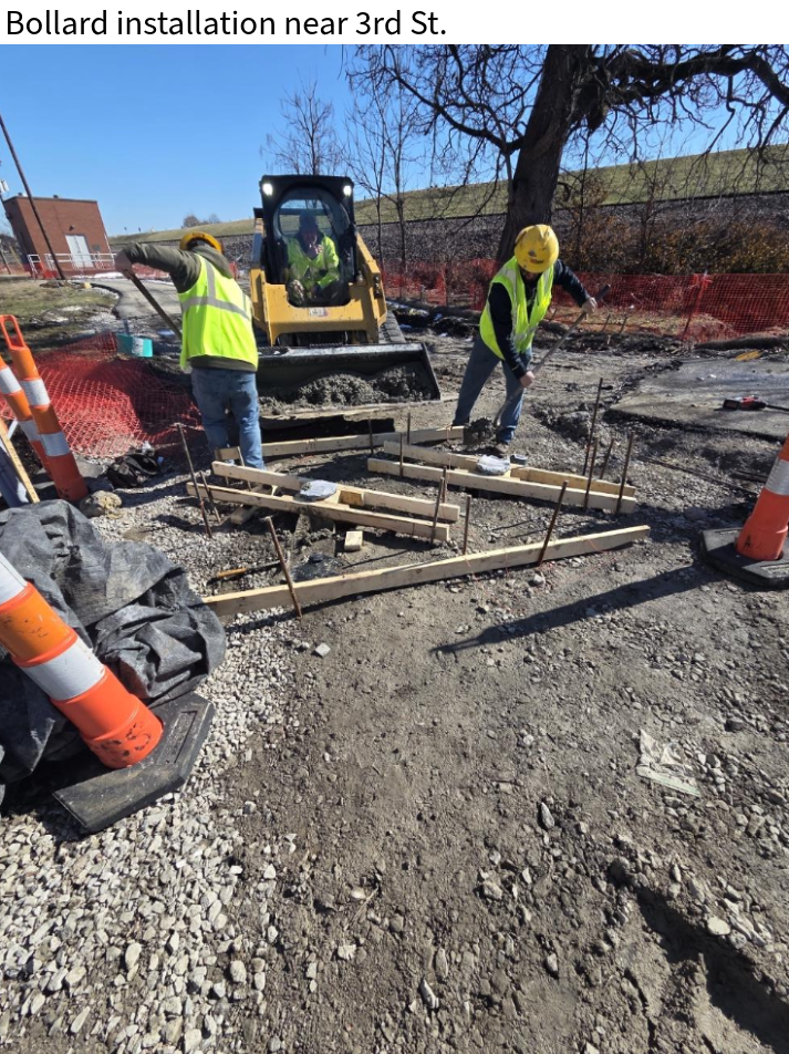
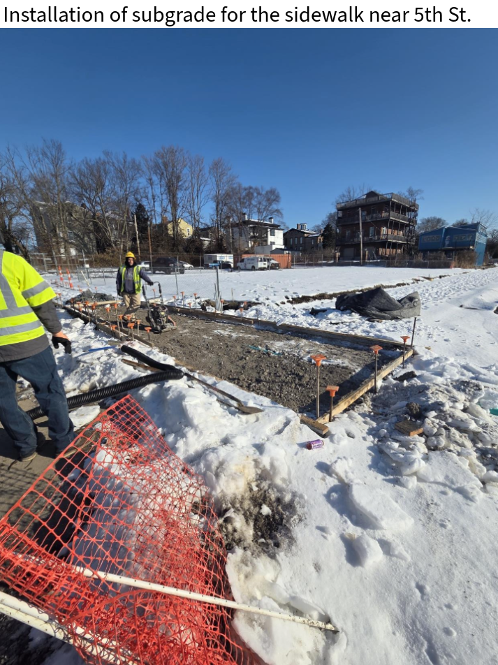
In addition, crews installed 10 decorative light pole foundations, bollards on Third Street, and subgrade treatment for the sidewalk on Fifth Street.
2/06/26
No work was completed over the past week due to the snow and freezing temperatures.
1/20/26
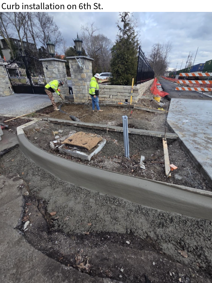
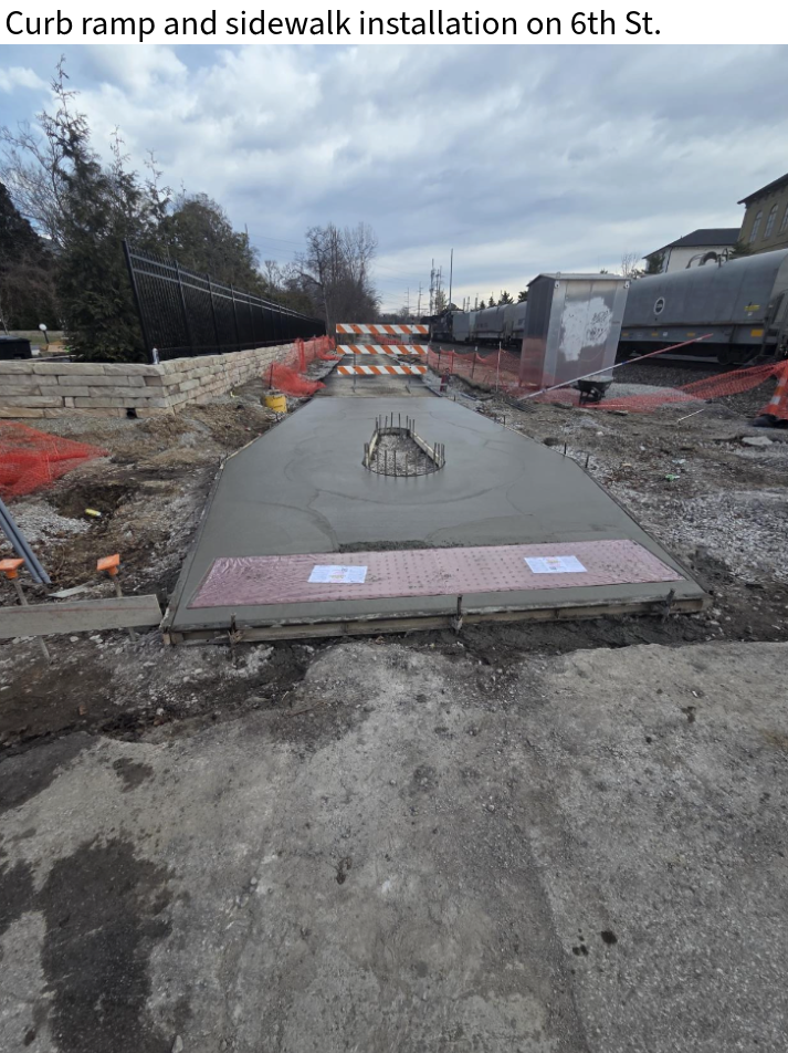
A curb ramp and sidewalk concrete has been installed on both sides of 6th Street.
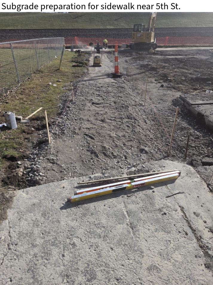
Crews have begun preparing the subgrade for sidewalk concrete on the west side of 5th Street.
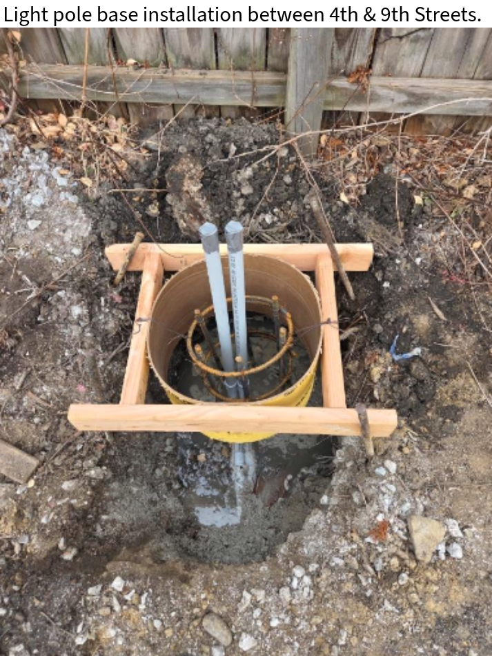
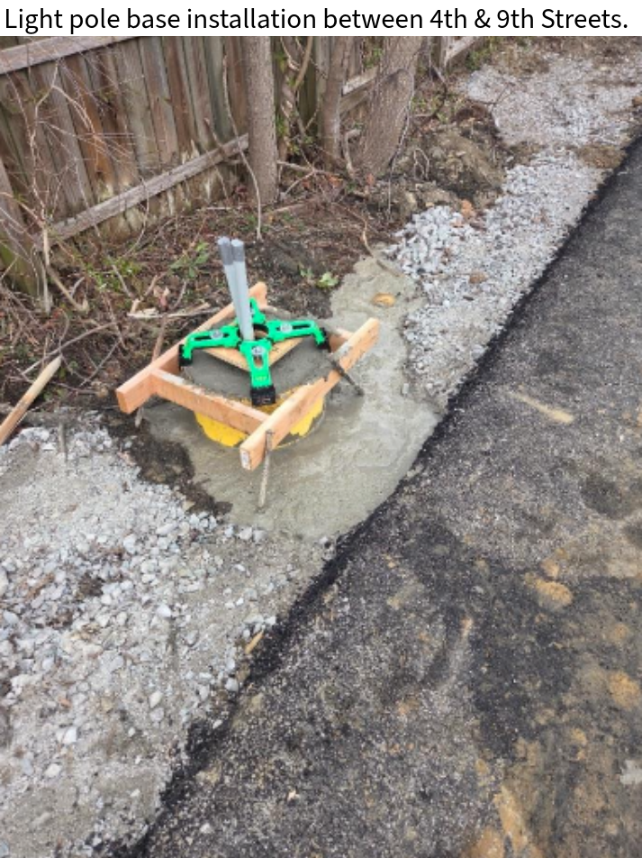
Light pole bases are continuing to be installed along 4th Street north of Culbertson Ave.
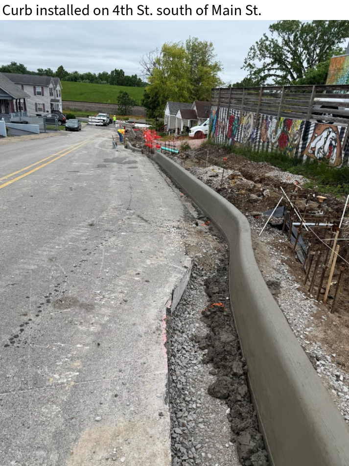
1/14/26
Crews installed curbs and gutters along 4th Street north of Culbertson Avenue, as well as between Bank Street and Third Street. Along 4th Street the areas between the curbs, gutters, and ashpalt were then infilled with concrete to allow for traffic.
Excavation also began on the west side of 4th Street between the trail and Main Street.
Light pole bases have been installed along the trail between 9th Street and 4th Street
12/16/25
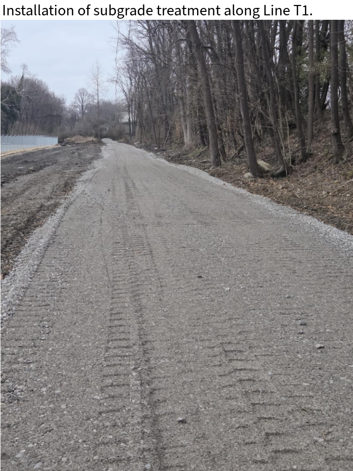
Crews continued installing subgrade treatment along Line T1 in preparation for ashpalt paving.
A 1’ undercut was completed in two locations near 4th Street to help mitigate subgrade failures.
Excavation and preparation of the paver areas along Line T at both 4th Street and 3rd Street have begun.
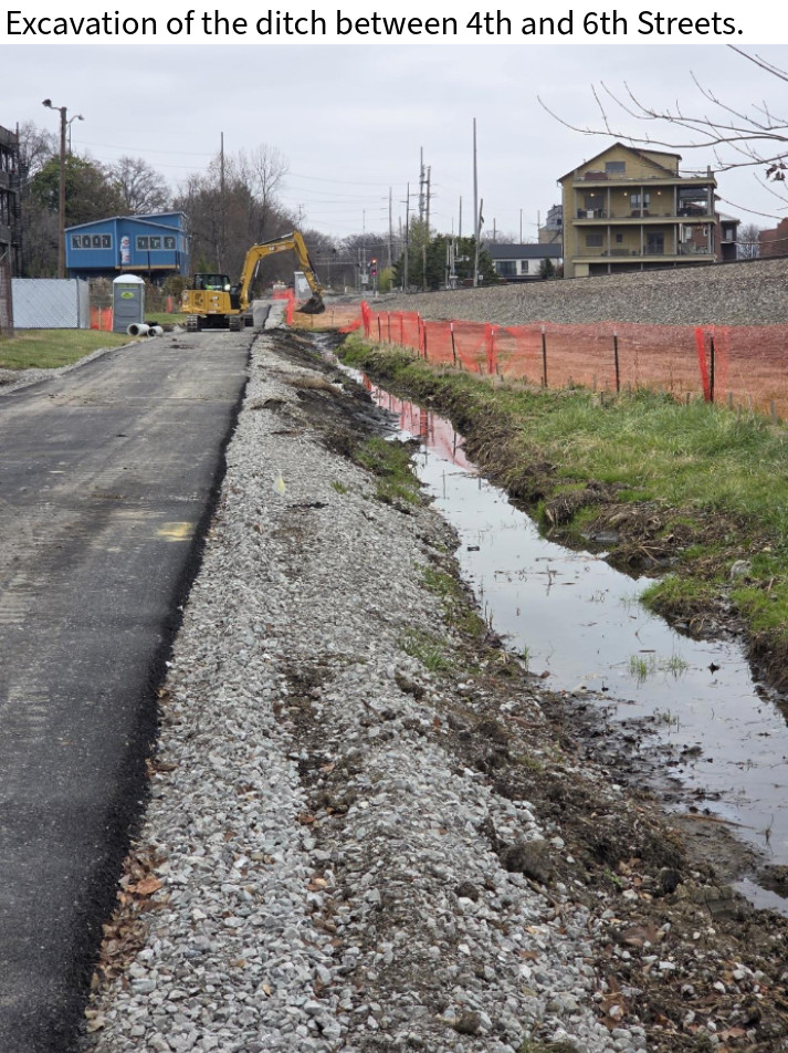
Additionally, crews began to clean and excavate the ditch along the south side of the trail between 6th Sreet and 4th Street.
12/08/25
Crews continued to prepare the subgrade for curb installation between Bank Street and 3rd Street, as well as ashpalt paving along line T1.
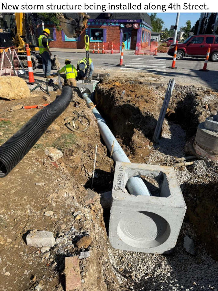
A new storm structure and pipe were installed along 4th Street. The pipe was backfilled under the road with flowable fill, and concrete collars were poured around the pipe openings.
The overall project is now estimated to be approximately 18% complete.
12/03/25
Crews continued preparing the subgrade for curb installation and fixed the temporary pavement markings on 4th Street.
A new storm structure and pipe were installed on 4th Street since the existing structure could not be tied into. The pipe was backfilled under the road with flowable fill.
Progress this week was slower than usual due to the weather and holiday schedule.
11/24/25
Crews maintained erosion control after a rain event which also slowed progress throughout the week.
Crews prepared the subgrade for curb installation.
Temporary pavement markings were installed on 4th Street in Line T1.
11/19/25
Crews began to excavating and removing portions of the curb and roadway on 4th Street for line T1, near Padgett, INC to Culbertson Ave.
Subgrade treatment continues to be installed along line T1.
Storm Structure 229 was installed in line T1, along with a pipe under the roadway to connect the new structure with the existing system.
11/12/25
HMA base paving between 9th Street and and Bank Street has been completed.
Crews have been mobilized to the other end of the job site to begin focus on Line T1. On 4th Street past Padgett INC. crews have begun grading operations, subgrade treatment installation, and installation of electrical conduit.
The project is estimated at nearly 12% complete as of now.
11/03/25
Preparation is underway for the asphalt paving between 9th Street and Bank Street. Multiple days of rain this week have caused a slight delay in progress.
Lateral drains were installed to divert water from the drain lines coming downhill from north of the trail. This water will now be redirected under the trail.
Excavation has also begun in preparation for the curb installation on Fifth Street.
10/27/25
Crews continued installing electrical conduit between Fourth Street and Bank Street for future trail lighting. Concrete bases for the lights are expected to be poured next week.
The final subgrade treatment is underway between 9th Street and Bank Street and will continue into next week.
At this stage, the overall project is approximately 8% complete.
10/17/25
Per SME Geotech’s recommendation, MAC continued installing undercut treatment between 6th Street and 5th Street. This work was inspected by an SME representative.
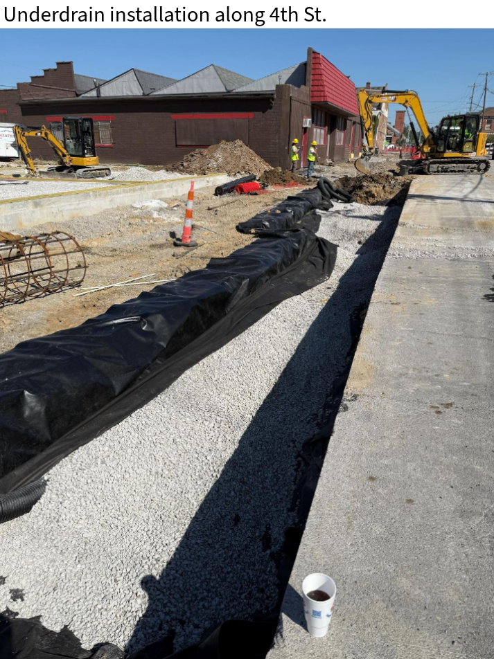
Crews completed installation of the underdrain pipe between 9th Street and 6th Street, as well as the electrical conduit for future lighting between 9th Street and 4th Street.
A new pipe has been installed across the trail between 6th and 5th Streets to capture water draining from the uphill side of the trail and redirect it to the ditch along the railroad side.
10/06/25
Crews removed an existing pipe and catch basin near 4th Street and installed multiple storm sewers with new pipe and end sections in the area.
New storm structures were also installed on both the west and east sides of 6th Street. These structures were connected by pipe and then backfilled with flowable fill concrete.
Between 6th and 5th Streets, MAC excavated an additional foot for the undercut. Crews placed the first layer of geotextile and geogrid, and began placing a 14-inch lift of #8 stone as directed by the SME Geotech.
An SME representative was on site to inspect the undercut treatment.
09/29/25
The grading for the trails in Line T and Line C has been completed. Crews have also begun placing and compacting subgrade treatment west of Fifth Street.
HWC and MAC are working together to determine the best solution for mitigating the soft subgrade in areas between 6th Street and 9th Street. This is a result of the excess water from lateral drains coming downhill from homes and businesses on Main Street.
In addition, storm sewer structures are being installed in Line C near Bank Street.
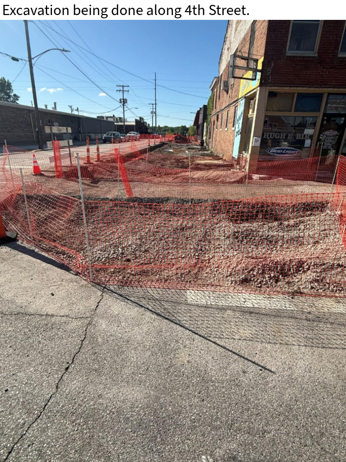
9/15/25
Crews have started the excavation process for “Line T”. They started working in both directions near the railroad tracks at the end of 9th Street, and have already made it past 5th Street.
Subgrade treatment is being placed in the excavated areas. However drainage issues (pictured below) west of 9th Street have caused a slight delay.
In the coming day crews will continue to excavate and install subgrade treatment where appropriate, find a solution to the drainage issues, as well as begin the installation of conduit along the edge of the trail in “Line T” to be used for lighting in the future.
9/03/25
Over the next two weeks, work will focus primarily on Line C (running parallel to the railroad tracks from Bank Street to 4th Street) and Line T (from 4th Street down to 10th Street).
Clearing has already begun along the property lines north of the railroad right-of-way and is expected to be completed by the end of the week.
Once clearing is completed, crews will install a silt fence and any other necessary erosion prevention and sediment control measures.
Finally, demolition will begin on the existing pavement east of 4th & 9th Streets, as well as the concrete wall/barrier at the end of 9th Street.
8/20/25
In July 2025, letters were sent to adjacent property owners to inform them of upcoming work.
Mobilization - August 1, 2025.
Groundbreaking Event was held on August 14, 2025 at 11:00 a.m.