Solid Flood Protection for New Albany - No Emergency Rescues, No One Displaced

PUBLIC SAFETY UPDATE REGARDING FLOODING

flooding 2.26.18.jpg

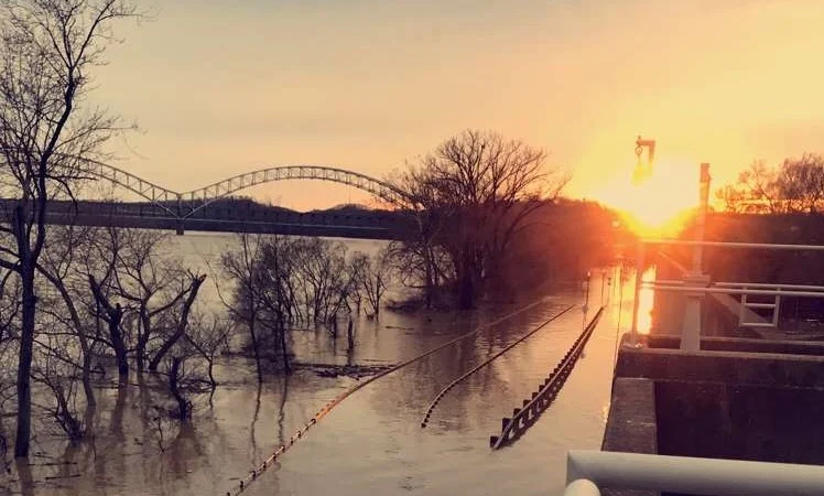
As of Tuesday afternoon, no reports of displaced residents have been made with City of New Albany offices. The New Albany Fire Department also reported that no water rescues were necessary.

“Over my 27 years of service in law enforcement, I have never seen a better response to a flood event than we have seen with this recent one in New Albany,” stated New Albany Police Chief Todd Bailey.

The NAPD and NAFD had additional officers and firefighters on staff during the period to improve public safety. No calls for service were made to the NAPD or NAFD with regards to flooding issues.

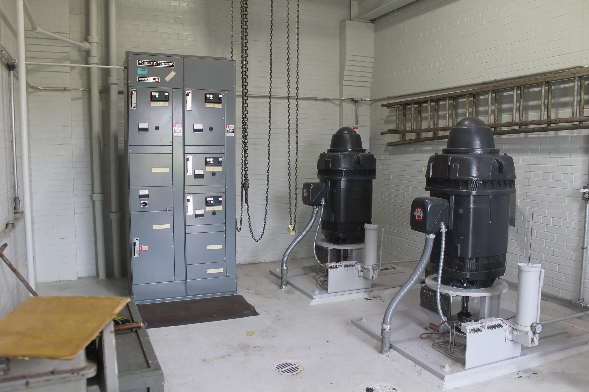
“In years past for similar rain events, we would have to make numerous water rescues to save residents in neighborhoods that have been flooded. Thanks to the numerous infrastructure improvements made throughout the city, New Albany residents were not in need of water rescues from this event,” stated New Albany Fire Chief Matt Juliot.

Flood Control and Stormwater Operations Continue - Crest Projected on Monday Afternoon

Flood Control operations continue as the Ohio River reached 66.36 feet as of 4pm on Sunday. New projections are showing a crest on Monday at 1pm at a height of 67.4 feet. Water levels should begin decreasing at a slow rate, but projections anticipate the water level still being above 60 feet by next Friday (March 2nd). Pumphouses continue to operate and be staffed around the clock, moving over 200,000 gallons of water per minute.

“Our Stormwater and Flood Control systems are operating as intended,” stated Mayor Jeff Gahan. “Provided that we do not receive too much additional rain through next week, we should see the water levels begin to recede soon.”

IMG_2995.JPG

Here are some good historical reference points for the highest water level at crest:

  1. 85.4 feet on January 27th, 1937
  2. 74.4 feet on March 7th, 1945
  3. 74.4 feet on February 16th, 1884
  4. 73.4 feet on March 13th, 1964
  5. 72.7 feet on April 2nd, 1913
  6. 72.2 feet on February 16th, 1883
  7. 70.4 feet on March 7th, 1997
  8. 69.6 feet on February 21st, 1832
  9. 69.1 feet on January 22nd, 1907
  10. 68.8 feet on December 17th, 1847

PLEASE DO NOT DRIVE THROUGH STANDING WATER.

Please report Stormwater issues at 812-945-1989 (7:30am-3:30pm Mon-Fri), or after-hours at 502-558-1507.
 

Ohio River Continues to Rise - City Continues Flood Control Operations

Flood control operations in New Albany are revving up and pump stations will be fully staffed around the clock for the next seven days, maybe more.

The Ohio River continues to rise. Current river level projections (as of 11am on 2/23/18) show the river reaching 65.9 feet on Tuesday.

Construction of the three-story West 10th street floodwall closure began yesterday at 5:00pm. The New Albany Fire Department & Flood Control District personnel completed the structure at 2:30am. The closure creates a continuous seal and prevents river water from entering into the western part of the city.

Members of the New Albany Flood Control District & New Albany Fire Department work to complete the closure at West 10th Street.

Members of the New Albany Flood Control District & New Albany Fire Department work to complete the closure at West 10th Street.

IMG_4274.JPG
IMG_2940.JPG

The New Albany Police Department has increased staff and patrols for additional oversight of high water areas in and around the city. Additionally, the Flood Control District Director has met with our local EMS Director to share safety protocols and measures.

“Even though it makes for some wonderful viewing opportunities, I would encourage everyone to respect Mother Nature and the high water. The City of New Albany has a history of a high rising Ohio River, but we also have an $80 million flood control system and public asset which helps keep the river in check. Be cautious – it will be messy and inconvenient for awhile,” stated Mayor Jeff Gahan.

Please report Stormwater issues at 812-945-1989 (7:30am-3:30pm Mon-Fri), or after-hours at 502-558-1507.

IMG_2947.JPG
IMG_2948.JPG

City Activates Pumping Plants as Ohio River Reaches "Flood Stage"

Early Tuesday morning, the Ohio River rose above 55 feet. This puts the city into a "flood stage" classification.

IMG_0087.JPG

Last night at approximately 11 pm, the New Albany Flood Control District put two pumping stations into operation, the Falling Run Pumping Plant and the Chamber Street Pumping Plant. These two pump plants will run 24 hours a day, 7 days a week with a staff member present until flood waters recede below the 55 feet line.

In 2014, all six pumping plants (a total of nineteen pumps) were remanufactured and had their motors replaced, and work was done to the pumping plant facilities themselves, including ventilation work, electrical and structural upgrades, and minimal facade work to improve the overall functionality of the buildings.

Falling Run Pumping Station

Falling Run Pumping Station

Chamber Street Pumping Plant

Chamber Street Pumping Plant

Projections as of 2/20/18 show that the river will crest sometime late Thursday evening or early Friday morning at 59 feet. This projection is based on the latest available information and is subject to change.

In the early hours of Tuesday morning, the Falling Run Creek ponding area was pumped to its lowest elevation to increase storage capabilities for the incoming rains.

Armstrong Road and Old Ford Road (at the intersection of Armstrong and Old Ford) remain closed due to high waters.

DO NOT DRIVE THROUGH STANDING WATER.

Mt. Tabor Road Project Update

On January 2nd, the City of New Albany held the third public information meeting for the Mt. Tabor Road Project. After receiving feedback and comments from residents and engineers, the City of New Albany has removed plans to modify the intersection at Mt. Tabor Road and Klerner Lane. As part of this federally-funded project, the four-way stop will remain.

The city will continue forward with the rest of the Mt. Tabor Road Improvement project, including new drainage, curbs, and sidewalks on both sides of the roadway. Signals will be updated at both Mt. Tabor Road and Charlestown Road, as well as the Mt. Tabor Road and Grant Line Road intersections.

In 2013, the roadway experienced a failure along the north hillside near East Oakwood Drive. The city immediately proceeded with an emergency, temporary repair at the road slide in order to keep the roadway safe. The Mt. Tabor Road Improvement project will provide a long-term fix for the stabilization issues along Mt. Tabor Road.

The City of New Albany will complete a new traffic survey and analysis regarding the reconstruction of the intersection at Mt. Tabor Road and Klerner Lane at a later date.

“We will keep working to improve the roadway and infrastructure at Mt. Tabor Road,” stated Mayor Jeff Gahan. “We welcome and appreciate the input and feedback from our neighbors and business owners. Please stay connected by reading the News and Tribune and by visiting our website.”